In addition to fish and zooplankton data, hydroacoustic surveys simultaneously provide information on aquatic habitat (bathymetry and quantified thermal habitat mapping), bottom substrate classification (relative hardness and roughness), and macrophyte mapping. Such mapping can be used, among other purposes, for assessment of the quantity and quality of spawning habitat, characterization of the spatial association between fish and specific habitat features, and provision of detailed lake and river-bottom relief for navigational purposes.
Fish Habitat And SAV Mapping
Fish Habitat and Submerged Aquatic Vegetation (SAV) Mapping
Multibeam Sonar Lake Bottom Imaging and Mosaics
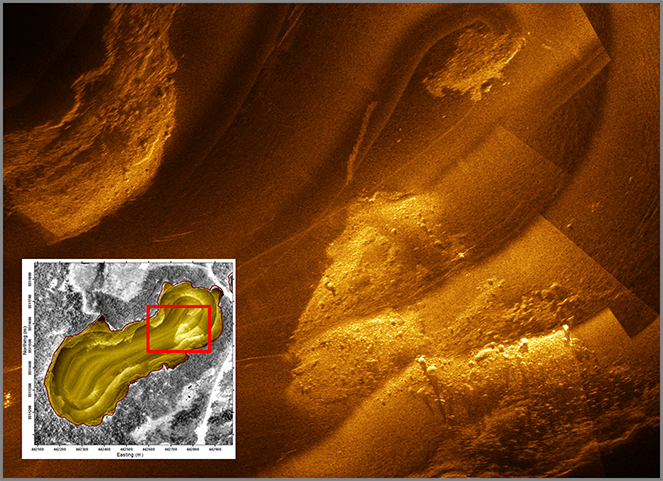
Milne Technologies provides sonar imaging of the nearshore lake or river bottom habitat using a side- or forward-looking Kongsberg Mesotech M3 multibeam sonar system. In real-time, we can use the Oceanic Imaging Consultants “Stand-Alone Mosaicking Module (SAMM)” sonar image processing software to generate acoustic “pictures” of the bottom and stitched together into a habitat mosaic. Bottom substrate features (rock, cobble, wood debris, sand-bars, etc.) and sub-surface structures (water intake pipes and caps, dredge cuts, etc.) can be readily identified and geo-referenced.
Submerged Macrophytes
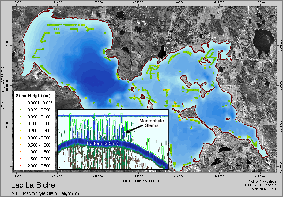
Aquatic macrophytes provide critical nursery habitat, refuge from predators, and critical habitat for aquatic invertebrates and fish within lakes, streams, and marine environments. Hydroacoustics provide an efficient method for determining the spatial distribution and extent of submerged macrophyte beds. Measurements such as stem height and weed-bed volume can be derived from the collected hydroacoustic survey data. This type of information can be used to monitor temporal changes in macrophytes, which can further be compared to, for example, the spatial distribution of fish and invertebrates and environmental variability.